Laramie
County, WY Floodplain Interactive Map
Help Home Cheyenne and Laramie
County GIS Cooperative
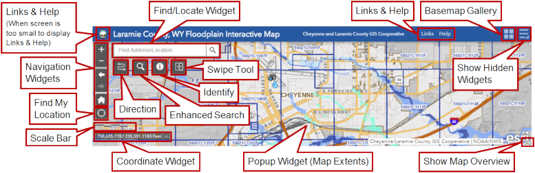
Application Screen and Tools
(Click on label or highlighted area for help on that item)
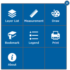
Hidden Widgets Panel and Tools
(Dependent on screen size, these tools may be located on the map's header, or in the Hidden Widgets
Panel. Click on the widget icon in the image below to view its help page.)