Popup Widget Help
Cheyenne and Laramie County GIS Cooperative
| PLSS Corner Records Interactive Map, Laramie County, WY Popup Widget Help Cheyenne and Laramie County GIS Cooperative |
 feature anywhere within the extent of the map will open the Popup Widget.
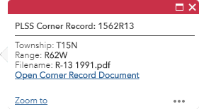
 in the upper left corner as shown in the (1of 3) and (2 of 3) examples below.
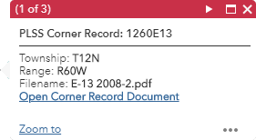
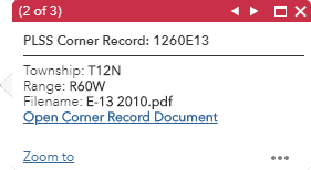
 will display the attribute information for the next feature.
 will display the attribute information for the previous feature.
 will maximize the size of the Popup Widget window.
 will return the Popup Widget window to its original size.
 will close the Popup Widget.